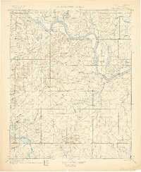
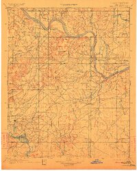
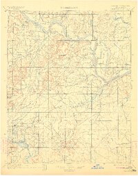
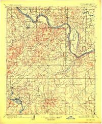
1900 Map of Okmulgee
USGS Topo · Published 1900About this map
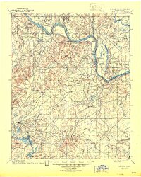
Indian Territory (Creek Nation) transitions from the hilly terrain of the Conjada Mts and Concharty Mtn into the fertile alluvial valleys of the Arkansas River during the late nineteenth century. This era of settlement is defined by established outposts like Okmulgee and religious centers such as Wealaka Mission. The landscape is etched with countless creek systems, including Deep Fork Canadian River and Coal Creek, which supported early communities like Wellington (Lee P.O.) and Council Hill. The mapping reveals a network of early post offices and missions that served as the primary hubs for the Creek Nation before Oklahoman statehood. Further east, the confluence of the Verdigris River and the Arkansas marks a significant geographic junction near Coweta, illustrating the riverine-dependent nature of life in the territory at this time.
Find a feature on this map
39 named features on this map. Tap any name to fly to it.
Don’t see what you’re looking for? This feature index may not catch every label — zoom into the map to look around manually.
Map Details
Editions of this 1900 Okmulgee Map
6 editions found