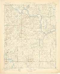
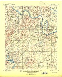
1900 Map of Okmulgee
USGS Topo · Published 1900About this map
Okmulgee serves as a primary center of the Creek Nation in the final years of Indian Territory, just before Oklahoma statehood. This survey, conducted by Van H. Manning and others, documents a landscape of tribal missions and early settlements along the meandering Arkansas River. The map captures the spiritual and educational footprint of the region through landmarks like the Wealaka Mission and a second Mission located south of the main Okmulgee townsite.
Find a feature on this map
55 named features on this map. Tap any name to fly to it.
Don’t see what you’re looking for? This feature index may not catch every label — zoom into the map to look around manually.
Map Details
Editions of this 1900 Okmulgee Map
6 editions found
Other maps of this area

1896 · Okmulgee
USGS Topo · 1:125,000

1896 · Pryor
USGS Topo · 1:125,000

1900 · Sansbois
USGS Topo · 1:125,000

1900 · Canadian
USGS Topo · 1:125,000

1900 · Wewoka
USGS Topo · 1:125,000

1900 · Okmulgee
USGS Topo · 1:125,000

1901 · Muscogee
USGS Topo · 1:125,000

1901 · Claremore
USGS Topo · 1:125,000

1901 · Pryor
USGS Topo · 1:125,000

1901 · Nuyaka
USGS Topo · 1:125,000