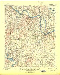
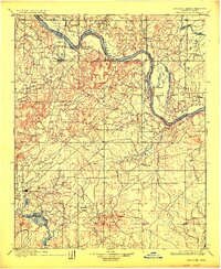
1900 Map of Okmulgee
USGS Topo · Published 1945About this map
The Arkansas River and Verdigris River define the northern landscape of the Creek Nation in this survey from the final years of the Indian Territory era. Okmulgee serves as a primary hub in the southwest, while several smaller settlements and post offices are scattered throughout the territory, including Wellington (Lee P.O.) and Council Hill. The map documents a transition from established tribal centers like the Wealaka Mission and a second Mission near Okmulgee to emerging river towns such as Coweta and Choska. These early place names and the network of primitive roads provide a window into the settlement patterns prior to Oklahoma statehood. The terrain is marked by prominent elevations like the Conjada Mts. and Concharty Mt., while the southern reaches are dominated by the winding path of the Deep Fork and its many tributaries, such as Cane Creek and Pecan Creek.
Find a feature on this map
33 named features on this map. Tap any name to fly to it.
Don’t see what you’re looking for? This feature index may not catch every label — zoom into the map to look around manually.
Map Details
Editions of this 1900 Okmulgee Map
6 editions found
Other maps of this area

1896 · Okmulgee
USGS Topo · 1:125,000

1896 · Pryor
USGS Topo · 1:125,000

1900 · Sansbois
USGS Topo · 1:125,000

1900 · Canadian
USGS Topo · 1:125,000

1900 · Wewoka
USGS Topo · 1:125,000

1900 · Okmulgee
USGS Topo · 1:125,000

1901 · Muscogee
USGS Topo · 1:125,000

1901 · Claremore
USGS Topo · 1:125,000

1901 · Pryor
USGS Topo · 1:125,000

1901 · Nuyaka
USGS Topo · 1:125,000