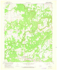
1966 Map of Haywood
USGS Topo · Published 1968About this map
Haywood and Arpelar anchor this section of Pittsburg County in the mid-1960s, a landscape defined by small rural settlements and a significant military footprint. The southern edge of the sheet is dominated by the U S Naval Ammunition Depot, showing the intersection of local geography with mid-century defense infrastructure. Local history is preserved through numerous rural landmarks, including the Christian Hill Cem and Arpelar Cem, alongside several small churches like Zion Ch near Tannehill Prairie.
Find a feature on this map
23 named features on this map. Tap any name to fly to it.
Don’t see what you’re looking for? This feature index may not catch every label — zoom into the map to look around manually.
Map Details
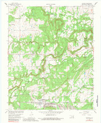
Editions of this 1966 Haywood Map
2 editions found
Other maps of this area

1896 · Coalgate
USGS Topo · 1:125,000

1898 · McAlester
USGS Topo · 1:125,000

1899 · Coalgate
USGS Topo · 1:125,000

1900 · Canadian
USGS Topo · 1:125,000

1900 · Wewoka
USGS Topo · 1:125,000

1900 · Coalgate
USGS Topo · 1:125,000

1909 · Mc Alester
USGS Topo · 1:125,000

1946 · Fort Smith
USGS Topo · 1:250,000

1950 · Mcalester
USGS Topo · 1:250,000

1954 · Oklahoma City
USGS Topo · 1:250,000