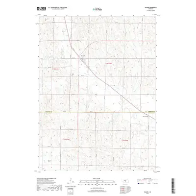
2017 Map of Hazard
USGS Topo · Published 2017About this map
Hazard and Sweetwater anchor this central Nebraska landscape, which straddles the boundary between Sherman and Buffalo Counties. The terrain is defined by the drainage networks of Mud Creek and Bloody Run Creek, which carve through the plains. The map reveals a strictly organized section line road system, including the notably named WPA Sherman Ave, reflecting federal labor influence on local infrastructure. In the southwestern portion of the sheet, Pleasant Valley represents a distinct geographic pocket near Dry Creek. For those tracing local heritage, the Hazard Cemetery and the original street layout of the village along Market Street provide concrete locations for family history research. The presence of Spring Branch and various county roads, such as County Road 15, further details the rural connectivity of this agricultural region in the early 21st century.
Find a feature on this map
50 named features on this map. Tap any name to fly to it.
Don’t see what you’re looking for? This feature index may not catch every label — zoom into the map to look around manually.
Map Details
Editions of this 2017 Hazard Map
This is the sole edition of this map. No revisions or reprints were ever made.
Other maps of this area

1896 · Kearney
USGS Topo · 1:125,000

1896 · Wood River
USGS Topo · 1:125,000

1899 · Loup
USGS Topo · 1:125,000

1951 · Litchfield SW
USGS Topo · 1:24,000

1951 · Litchfield NE
USGS Topo · 1:24,000

1951 · Hazard
USGS Topo · 1:24,000

1951 · Litchfield
USGS Topo · 1:24,000

1953 · Ravenna NW
USGS Topo · 1:24,000

1953 · Ravenna
USGS Topo · 1:24,000

1955 · Broken Bow
USGS Topo · 1:250,000