
1951 Map of Litchfield
USGS Topo · Published 1953About this map
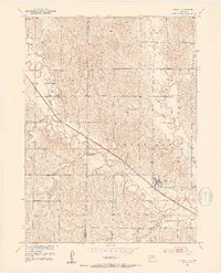
The village of Litchfield serves as the focal point of this Sherman County landscape, situated along the diagonal path of the Chicago Burlington and Quincy railroad. The 1950s terrain is characterized by a high density of rural schoolhouses, including Round Grove Sch, Shetler Sch, and Muddy Mills Sch, which underscore the era's decentralized education system across the townships of Algernon, Harrison, and Elk Creek.
Find a feature on this map
20 named features on this map. Tap any name to fly to it.
Don’t see what you’re looking for? This feature index may not catch every label — zoom into the map to look around manually.
Map Details
Editions of this 1951 Litchfield Map
2 editions found
Other maps of this area

1951 · Arcadia SE
USGS Topo · 1:24,000

1951 · Litchfield SW
USGS Topo · 1:24,000

1951 · Litchfield NE
USGS Topo · 1:24,000

1951 · Hazard
USGS Topo · 1:24,000

1951 · Mason City
USGS Topo · 1:24,000

1951 · Ansley SE
USGS Topo · 1:24,000

1951 · Mason City SE
USGS Topo · 1:24,000

1951 · Arcadia SW
USGS Topo · 1:24,000

1955 · Broken Bow
USGS Topo · 1:250,000

1956 · Broken Bow
USGS Topo · 1:250,000