
1951 Map of Mason City
USGS Topo · Published 1953About this map
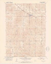
Mason City (Mason Sta) serves as the primary hub of this central Nebraska landscape, situated where the Chicago Burlington and Quincy railroad follows the winding path of Mud Creek. The 1951 field check reveals a post-war rural infrastructure defined by an exceptional density of country schools, such as Algernon Sch and Beechville Sch, which anchor the surrounding townships. The terrain is marked by significant drainages including Happy Hollow and Lazy Hollow, indicating the deep erosion patterns of the Loup River basin. Evidence of local industry and survival on the plains appears in the form of a Clay Pit and numerous windmills scattered across the uplands, which provided essential water for livestock in the Elk Creek drainage. This survey reflects the persistence of the traditional school district system before mid-century consolidation fully transformed the rural Nebraska social fabric.
Find a feature on this map
23 named features on this map. Tap any name to fly to it.
Don’t see what you’re looking for? This feature index may not catch every label — zoom into the map to look around manually.
Map Details
Editions of this 1951 Mason City Map
4 editions found
Other maps of this area

1951 · Ansley
USGS Topo · 1:24,000

1951 · Litchfield SW
USGS Topo · 1:24,000

1951 · Mason City SW
USGS Topo · 1:24,000

1951 · Mason City NW
USGS Topo · 1:24,000

1951 · Ansley SE
USGS Topo · 1:24,000

1951 · Mason City SE
USGS Topo · 1:24,000

1951 · Arcadia SW
USGS Topo · 1:24,000

1951 · Litchfield
USGS Topo · 1:24,000

1955 · Broken Bow
USGS Topo · 1:250,000

1956 · Broken Bow
USGS Topo · 1:250,000