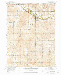
1951 Map of Mason City
USGS Topo · Published 1977About this map
Mason City serves as the central hub of this Custer County landscape, situated where the Chicago Burlington and Quincy railroad follows the winding path of Mud Creek. The 1951 field check reveals a community-centered rural structure defined by numerous local schoolhouses distributed across the townships, including Algernon Sch, Happy Hollow Sch, and Beechville Sch. These institutions, alongside Union Hill Sch and Mt Pleasant Sch, highlight the importance of localized education for the farmsteads scattered between the draws of Happy Hollow and Lazy Hollow.
Find a feature on this map
20 named features on this map. Tap any name to fly to it.
Don’t see what you’re looking for? This feature index may not catch every label — zoom into the map to look around manually.
Map Details
Editions of this 1951 Mason City Map
4 editions found
Other maps of this area

1951 · Ansley
USGS Topo · 1:24,000

1951 · Litchfield SW
USGS Topo · 1:24,000

1951 · Mason City SW
USGS Topo · 1:24,000

1951 · Mason City NW
USGS Topo · 1:24,000

1951 · Mason City
USGS Topo · 1:24,000

1951 · Ansley SE
USGS Topo · 1:24,000

1951 · Mason City SE
USGS Topo · 1:24,000

1951 · Arcadia SW
USGS Topo · 1:24,000

1951 · Litchfield
USGS Topo · 1:24,000

1955 · Broken Bow
USGS Topo · 1:250,000