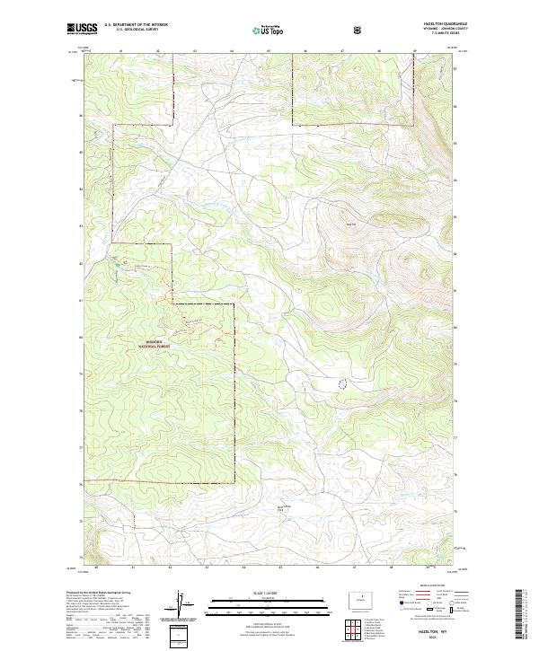
2021 Map of Hazelton
USGS Topo · Published 2021About this map
Bighorn National Forest defines the western half of this Johnson County landscape, where the high-altitude terrain is carved by the headwaters of numerous mountain streams. The intricate drainage network includes Middle Fork Crazy Woman Cr and Poison Cr, which descend through several steep-sided canyons. The map documents a blend of early-20th-century water management and modern recreational access, most notably seen in the Hazelton Ditch and the primitive paths of Doyle Creek Trl and Shorter Trl.
Find a feature on this map
24 named features on this map. Tap any name to fly to it.
Don’t see what you’re looking for? This feature index may not catch every label — zoom into the map to look around manually.
Map Details
Editions of this 2021 Hazelton Map
This is the sole edition of this map. No revisions or reprints were ever made.
Other maps of this area

1899 · Cloud peak
USGS Topo · 1:125,000

1900 · Fort McKinney
USGS Topo · 1:125,000

1901 · Cloud Peak
USGS Topo · 1:125,000

1903 · Fort McKinney
USGS Topo · 1:125,000

1955 · Sheridan
USGS Topo · 1:250,000

1955 · Arminto
USGS Topo · 1:250,000

1958 · Sheridan
USGS Topo · 1:250,000

1958 · Arminto
USGS Topo · 1:250,000

1962 · Sheridan
USGS Topo · 1:250,000

1962 · Arminto
USGS Topo · 1:250,000