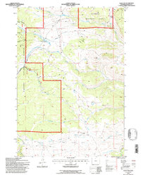
1993 Map of Hazelton
USGS Topo · Published 1997About this map
Hazelton sits at the center of this high-elevation landscape, where the Bighorn National Forest boundary meets extensive water management and grazing infrastructure. The map documents a rugged drainage network where the Middle Fork Crazy Woman Creek and Doyle Creek carve through the terrain, supported by the Hazelton Ditch and numerous unnamed springs. Evidence of early land use and local history is sparse but specific, including a marked grave near the settlement site and a remote cabin further south. The southern portion of the quadrangle opens into the broad expanse of Bull Camp Park, a notable break in the timbered slopes. Resource exploration is indicated by several prospects near Mottox Creek, while the presence of a stock tank and multiple corral sites suggests the area remained vital for livestock range management into the late twentieth century.
Find a feature on this map
26 named features on this map. Tap any name to fly to it.
Don’t see what you’re looking for? This feature index may not catch every label — zoom into the map to look around manually.
Map Details
Editions of this 1993 Hazelton Map
This is the sole edition of this map. No revisions or reprints were ever made.
Other maps of this area

1899 · Cloud peak
USGS Topo · 1:125,000

1900 · Fort McKinney
USGS Topo · 1:125,000

1901 · Cloud Peak
USGS Topo · 1:125,000

1903 · Fort McKinney
USGS Topo · 1:125,000

1955 · Sheridan
USGS Topo · 1:250,000

1955 · Arminto
USGS Topo · 1:250,000

1958 · Sheridan
USGS Topo · 1:250,000

1958 · Arminto
USGS Topo · 1:250,000

1962 · Sheridan
USGS Topo · 1:250,000

1962 · Arminto
USGS Topo · 1:250,000