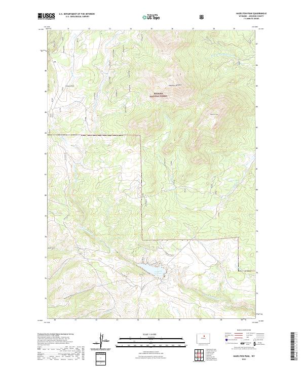
2021 Map of Hazelton Peak
USGS Topo · Published 2021About this map
The high country of the Bighorn National Forest dominates this landscape, where the headwaters of several critical Wyoming waterways begin their descent. High peaks like Hazelton Peak and the Hazelton Pyramid overlook a network of creeks and canyons that define the local topography. The N Fork Powder River carves through the western half of the sheet, while the Middle Fork Crazy Woman Cr drains toward the northeast.
Find a feature on this map
24 named features on this map. Tap any name to fly to it.
Don’t see what you’re looking for? This feature index may not catch every label — zoom into the map to look around manually.
Map Details
Editions of this 2021 Hazelton Peak Map
This is the sole edition of this map. No revisions or reprints were ever made.
Other maps of this area

1899 · Cloud peak
USGS Topo · 1:125,000

1900 · Fort McKinney
USGS Topo · 1:125,000

1901 · Cloud Peak
USGS Topo · 1:125,000

1903 · Fort McKinney
USGS Topo · 1:125,000

1955 · Sheridan
USGS Topo · 1:250,000

1955 · Arminto
USGS Topo · 1:250,000

1958 · Sheridan
USGS Topo · 1:250,000

1958 · Arminto
USGS Topo · 1:250,000

1962 · Sheridan
USGS Topo · 1:250,000

1962 · Arminto
USGS Topo · 1:250,000