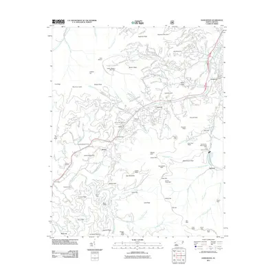
2011 Map of Hazelwood
USGS Topo · Published 2011About this map
Richland Creek and Scott Creek carve through the high terrain of Haywood County, shaping the settlement patterns of this Blue Ridge mountain corridor. This early 21st-century survey documents the transition from the concentrated residential and industrial areas of Hazelwood to the more dispersed communities of Balsam and Saunook. The landscape is defined by its infrastructure, from the high-elevation traverse of the Blue Ridge Pkwy to the Pinnacle Ridge Tunnel and the Waynesville Water Supply Dam on Allen Creek. Local history is anchored by numerous family and community sites, including Redbank Cemetery, Crawford Cemetery, and the Morrison Fish Hatchery. The map captures the interface between managed lands and natural landmarks like Pinnacle Knob and Doubletop Mountain, reflecting an era where rural topography meets the modern transportation needs of the western North Carolina highlands.
Find a feature on this map
91 named features on this map. Tap any name to fly to it.
Don’t see what you’re looking for? This feature index may not catch every label — zoom into the map to look around manually.
Map Details
Editions of this 2011 Hazelwood Map
This is the sole edition of this map. No revisions or reprints were ever made.
Other maps of this area

1891 · Cowee
USGS Topo · 1:125,000

1893 · Mt Guyot
USGS Topo · 1:125,000

1894 · Asheville
USGS Topo · 1:125,000

1897 · Cowee
USGS Topo · 1:125,000

1901 · Asheville
USGS Topo · 1:125,000

1905 · Pisgah
USGS Topo · 1:125,000

1906 · Pisgah
USGS Topo · 1:125,000

1907 · Cowee
USGS Topo · 1:125,000

1912 · Mt Guyot
USGS Topo · 1:125,000

1935 · Waynesville
USGS Topo · 1:24,000