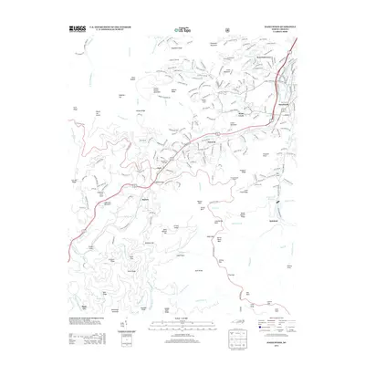
2013 Map of Hazelwood
USGS Topo · Published 2013About this map
Waynesville and the industrial enclave of Hazelwood anchor this survey of the high mountain gaps and ridges in Haywood County. The landscape is defined by the steep elevation changes between the urban valley and the heights of Eaglenest Mountain and Plott Balsam. Transportation routes like the Norfolk Southern railroad and the Blue Ridge Pkwy navigate these grades, notably at Balsam Gap and through the Pinnacle Ridge Tunnel. Local history is preserved in named landmarks such as the Morrison Fish Hatchery and several smaller settlements like Saunook, Clark, and Quinland. The map reveals the intricate network of water sources supporting the region, from the Waynesville Reservoir to the numerous branches feeding Richland Cr and Scott Cr. These features reflect a community shaped by its topography, where residential developments along Hyatt Creek meet the protected slopes of Judaculla Mountain.
Find a feature on this map
250 named features on this map. Tap any name to fly to it.
Don’t see what you’re looking for? This feature index may not catch every label — zoom into the map to look around manually.
Map Details
Editions of this 2013 Hazelwood Map
This is the sole edition of this map. No revisions or reprints were ever made.
Other maps of this area

1891 · Cowee
USGS Topo · 1:125,000

1893 · Mt Guyot
USGS Topo · 1:125,000

1894 · Asheville
USGS Topo · 1:125,000

1897 · Cowee
USGS Topo · 1:125,000

1901 · Asheville
USGS Topo · 1:125,000

1905 · Pisgah
USGS Topo · 1:125,000

1906 · Pisgah
USGS Topo · 1:125,000

1907 · Cowee
USGS Topo · 1:125,000

1912 · Mt Guyot
USGS Topo · 1:125,000

1935 · Waynesville
USGS Topo · 1:24,000