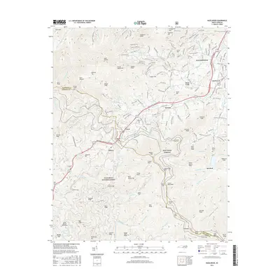
2016 Map of Hazelwood
USGS Topo · Published 2016About this map
Waynesville and the neighboring community of Hazelwood anchor the northeastern portion of this study, where the Southern Ry corridor follows the bend of Richland Creek. The landscape is defined by the significant elevation of the Plott Balsams, including peaks such as Plott Balsam and Mt Lyn Lowry, which rise sharply above the valleys. This area marks the boundary between Haywood and Jackson counties, where the Nantahala National Forest encompasses much of the western terrain. Small settlements and crossroads like Balsam, Saunook, and Ruby City are connected by mountain roads and the prominent Great Smoky Mountains Expressway, illustrating how modern infrastructure has adapted to the steep gaps of the Blue Ridge. Natural landmarks such as Woodfin Falls and numerous balds, including Wesner Bald and Grassy Bald, highlight the character of the high-country environment.
Find a feature on this map
199 named features on this map. Tap any name to fly to it.
Don’t see what you’re looking for? This feature index may not catch every label — zoom into the map to look around manually.
Map Details
Editions of this 2016 Hazelwood Map
This is the sole edition of this map. No revisions or reprints were ever made.
Other maps of this area

1891 · Cowee
USGS Topo · 1:125,000

1893 · Mt Guyot
USGS Topo · 1:125,000

1894 · Asheville
USGS Topo · 1:125,000

1897 · Cowee
USGS Topo · 1:125,000

1901 · Asheville
USGS Topo · 1:125,000

1905 · Pisgah
USGS Topo · 1:125,000

1906 · Pisgah
USGS Topo · 1:125,000

1907 · Cowee
USGS Topo · 1:125,000

1912 · Mt Guyot
USGS Topo · 1:125,000

1935 · Waynesville
USGS Topo · 1:24,000