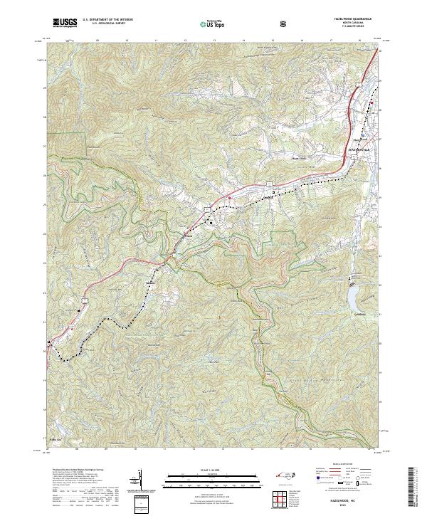
2023 Map of Hazelwood
USGS Topo · Published 2023About this map
Plott Balsams and the Great Balsam Mountains dominate this high-elevation landscape where the Jackson Co Haywood Co line follows the ridgelines of the Blue Ridge. The map shows a clear division between the developed valley floor near Waynesville and the protected wilderness of the Nantahala National Forest. Transportation routes like the Blue Ridge Parkway and the Great Smoky Mountains Expy navigate the steep terrain, connecting communities such as Saunook and Hazelwood.
Find a feature on this map
101 named features on this map. Tap any name to fly to it.
Don’t see what you’re looking for? This feature index may not catch every label — zoom into the map to look around manually.
Map Details
Editions of this 2023 Hazelwood Map
This is the sole edition of this map. No revisions or reprints were ever made.
Other maps of this area

1891 · Cowee
USGS Topo · 1:125,000

1893 · Mt Guyot
USGS Topo · 1:125,000

1894 · Asheville
USGS Topo · 1:125,000

1897 · Cowee
USGS Topo · 1:125,000

1901 · Asheville
USGS Topo · 1:125,000

1905 · Pisgah
USGS Topo · 1:125,000

1906 · Pisgah
USGS Topo · 1:125,000

1907 · Cowee
USGS Topo · 1:125,000

1912 · Mt Guyot
USGS Topo · 1:125,000

1935 · Waynesville
USGS Topo · 1:24,000