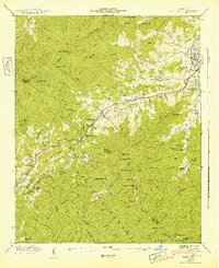
1942 Map of Hazelwood
USGS Topo · Published 1942About this map
Waynesville and Hazelwood serve as the primary hubs in this early 1940s survey of the mountain terrain where the Plott Balsams meet the Pisgah National Forest. The map documents a diverse local economy and infrastructure, ranging from the industrial presence of the Southern railroad and the Grassy Ridge Mine to state-run facilities like the Prison Camp and the Morrison Fish Hatchery. Small settlements like Saunook and Balsam are nestled along the winding Richland Creek, while the rural landscape is dotted with centers of community life including the Allen Creek Sch and multiple houses of worship such as Pleasant Balsam Ch and Fairview Ch.
Find a feature on this map
122 named features on this map. Tap any name to fly to it.
Don’t see what you’re looking for? This feature index may not catch every label — zoom into the map to look around manually.
Map Details
Editions of this 1942 Hazelwood Map
This is the sole edition of this map. No revisions or reprints were ever made.
Other maps of this area

1891 · Cowee
USGS Topo · 1:125,000

1893 · Mt Guyot
USGS Topo · 1:125,000

1894 · Asheville
USGS Topo · 1:125,000

1897 · Cowee
USGS Topo · 1:125,000

1901 · Asheville
USGS Topo · 1:125,000

1905 · Pisgah
USGS Topo · 1:125,000

1906 · Pisgah
USGS Topo · 1:125,000

1907 · Cowee
USGS Topo · 1:125,000

1912 · Mt Guyot
USGS Topo · 1:125,000

1935 · Waynesville
USGS Topo · 1:24,000