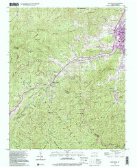
1997 Map of Hazelwood
USGS Topo · Published 2001About this map
Waynesville and the neighboring industrial community of Hazelwood anchor the eastern slopes of the Great Balsam Mountains in this topographic study. The landscape is defined by the steep transition from the urban centers along Richland Creek to the high-elevation ridges of the Plott Balsams. While the town centers show significant development, the western and southern reaches of the map reflect a more isolated, resource-based economy. Evidence of this is seen at the Grassy Ridge Mine and the Morrison Fish Hatchery located near Balsam.
Find a feature on this map
85 named features on this map. Tap any name to fly to it.
Don’t see what you’re looking for? This feature index may not catch every label — zoom into the map to look around manually.
Map Details
Editions of this 1997 Hazelwood Map
This is the sole edition of this map. No revisions or reprints were ever made.
Other maps of this area

1891 · Cowee
USGS Topo · 1:125,000

1893 · Mt Guyot
USGS Topo · 1:125,000

1894 · Asheville
USGS Topo · 1:125,000

1897 · Cowee
USGS Topo · 1:125,000

1901 · Asheville
USGS Topo · 1:125,000

1905 · Pisgah
USGS Topo · 1:125,000

1906 · Pisgah
USGS Topo · 1:125,000

1907 · Cowee
USGS Topo · 1:125,000

1912 · Mt Guyot
USGS Topo · 1:125,000

1935 · Waynesville
USGS Topo · 1:24,000