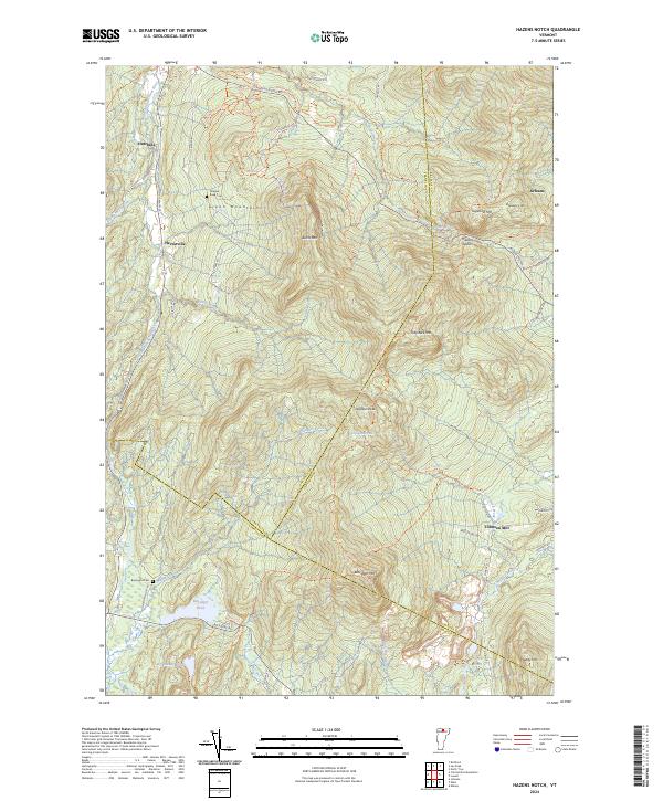
2024 Map of Hazens Notch
USGS Topo · Published 2024About this map
Hazens Notch serves as a central landmark in this portion of the Green Mountains, where the convergence of Franklin Co, Orleans Co, and Lamoille Co lines marks a high-altitude landscape of ridges and peaks. Small historic clusters like Hectorville and Hutchins sit along the western slopes, while Tillotson Mill is situated to the southeast. The terrain is defined by significant elevations including Belvidere Mtn, Tillotson Peak, and Sugarloaf Mtn, which are navigated by an extensive network of footpaths like The Long Trl and Catamount Trl.
Find a feature on this map
76 named features on this map. Tap any name to fly to it.
Don’t see what you’re looking for? This feature index may not catch every label — zoom into the map to look around manually.
Map Details
Editions of this 2024 Hazens Notch Map
This is the sole edition of this map. No revisions or reprints were ever made.
Other maps of this area

1919 · Montgomery
USGS Topo · 1:62,500

1920 · Montgomery
USGS Topo · 1:62,500

1920 · Irasburg
USGS Topo · 1:62,500

1923 · Irasburg
USGS Topo · 1:48,000

1925 · Irasburg
USGS Topo · 1:62,500

1925 · Jay Peak
USGS Topo · 1:62,500

1927 · Hyde Park
USGS Topo · 1:48,000

1928 · Hardwick
USGS Topo · 1:62,500

1930 · Hyde Park
USGS Topo · 1:62,500

1934 · Hardwick
USGS Topo · 1:48,000