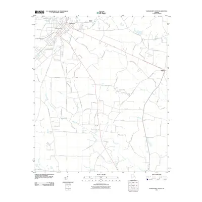
2011 Map of Hazlehurst South
USGS Topo · Published 2011About this map
Hazlehurst serves as the primary hub of this landscape, situated at the intersection of several key regional routes like Hollingsworth Blvd and Altamaha Rd. The town's civic core is anchored by the Hazlehurst Post Office, while the surrounding countryside is defined by the winding paths of Big Satilla Creek and Little Satilla Creek. These waterways, along with tributaries like Gully Creek and Hurricane Creek, create a distinct drainage pattern that has influenced the placement of local roads and smaller settlements like Satilla and Graham.
Find a feature on this map
96 named features on this map. Tap any name to fly to it.
Don’t see what you’re looking for? This feature index may not catch every label — zoom into the map to look around manually.
Map Details
Editions of this 2011 Hazlehurst South Map
This is the sole edition of this map. No revisions or reprints were ever made.
Other maps of this area

1953 · Waycross
USGS Topo · 1:250,000

1958 · Waycross
USGS Topo · 1:250,000

1970 · Pine Grove
USGS Topo · 1:24,000
1970 · Grays Landing
USGS Topo · 1:24,000

1971 · Nicholls NE
USGS Topo · 1:24,000

1971 · Roper
USGS Topo · 1:24,000
1971 · Hazlehurst North
USGS Topo · 1:24,000

1971 · Alma NW
USGS Topo · 1:24,000

1971 · Hazlehurst South
USGS Topo · 1:24,000

1971 · Denton
USGS Topo · 1:24,000