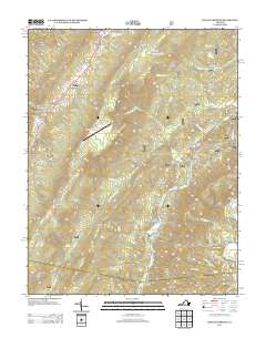
2013 Map of Healing Springs
USGS Topo · Published 2013About this map
Hot Springs and the surrounding resort area of Bath County are defined by a high-altitude landscape of thermal waters and ridges. This modern survey shows the developed corridor along US Route 220, connecting the primary settlements of Healing Springs, Ashwood, and Tinkertown. The terrain is marked by the dramatic crests of Warm Springs Mountain and Beards Mountain, which shelter the narrow valleys of Wilson Cr and Smith Cr.
Find a feature on this map
76 named features on this map. Tap any name to fly to it.
Don’t see what you’re looking for? This feature index may not catch every label — zoom into the map to look around manually.
Map Details
Editions of this 2013 Healing Springs Map
This is the sole edition of this map. No revisions or reprints were ever made.
Other maps of this area

1894 · Natural Bridge
USGS Topo · 1:125,000

1901 · Monterey
USGS Topo · 1:125,000

1923 · Warm Springs
USGS Topo · 1:48,000

1926 · Warm Springs
USGS Topo · 1:62,500

1929 · Falling Spring
USGS Topo · 1:24,000

1930 · Warm Springs Run
USGS Topo · 1:24,000

1930 · Mountain Grove
USGS Topo · 1:24,000

1931 · Healing Springs
USGS Topo · 1:24,000

1932 · Falling Spring
USGS Topo · 1:31,680

1933 · Mountain Grove
USGS Topo · 1:31,680