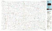
1985 Map of Healy
USGS Topo · Published 1985About this map
The Smoky Hill River carves a path through this section of Western Kansas, where the landscape is defined by the stark limestone formations of the Monument Rocks National Natural Landmark and the Chalk Pyramids. These geologic features served as navigational markers for travelers on the Butterfield Overland Trail, whose approximate historic route is traced across the high plains north of the river. By the mid-1980s, the region's infrastructure was anchored by the Missouri Pacific railroad, which links the small grain-handling communities of Healy, Shields, and Utica. This transition from early frontier trails to industrial rail transport is visible in the placement of these settlements. To the west, the Lake Scott State Park and Scott State Wildlife Area provide a contrast to the surrounding agricultural grid, protecting the drainage of Ladder Creek.
Find a feature on this map
53 named features on this map. Tap any name to fly to it.
Don’t see what you’re looking for? This feature index may not catch every label — zoom into the map to look around manually.
Map Details
Editions of this 1985 Healy Map
2 editions found
Other maps of this area

1892 · Ness
USGS Topo · 1:125,000

1893 · Ellis
USGS Topo · 1:125,000

1893 · Hill
USGS Topo · 1:125,000

1894 · Ness
USGS Topo · 1:125,000

1939 · Lake Mc Bride
USGS Topo · 1:24,000

1939 · Sandon
USGS Topo · 1:62,500

1939 · Pence
USGS Topo · 1:62,500

1940 · Scott City
USGS Topo · 1:62,500

1941 · Modoc
USGS Topo · 1:62,500

1941 · Pence
USGS Topo · 1:62,500