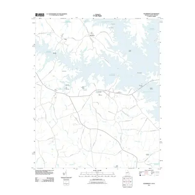
2011 Map of Heardmont
USGS Topo · Published 2011About this map
The settlement of Heardmont and the surrounding Elbert County countryside are defined by the expansive waters of Richard B Russell Lake. This 2011 survey documents a landscape where the river valley has been transformed into a series of interconnected reservoirs and dammed branches, including Lake Russell and Rice Lake. Historic community centers like Pearl and Beverly are situated among a network of local roads such as Pearl Mill Rd and Heardmont Rd. Genealogists will find a high concentration of burial sites throughout the quadrangle, including the centrally located Gods Acre Cemetery, as well as Dye Cemetery, Bethel Cemetery, and Hunters Chapel Cemetery. The map also captures several named geographical features within the lake, such as Carter Island and Paris Island, while the southern edge provides a glimpse of the J. Strom Thurmond Reservoir.
Find a feature on this map
69 named features on this map. Tap any name to fly to it.
Don’t see what you’re looking for? This feature index may not catch every label — zoom into the map to look around manually.
Map Details
Editions of this 2011 Heardmont Map
This is the sole edition of this map. No revisions or reprints were ever made.
Other maps of this area

1893 · Elberton
USGS Topo · 1:125,000

1906 · Crawfordville
USGS Topo · 1:125,000

1953 · Athens
USGS Topo · 1:250,000

1954 · Greenville
USGS Topo · 1:250,000

1955 · Broad
USGS Topo · 1:24,000

1955 · Chennault
USGS Topo · 1:24,000

1958 · Greenville
USGS Topo · 1:250,000

1958 · Athens
USGS Topo · 1:250,000

1958 · Elberton
USGS Topo · 1:62,500

1959 · Athens
USGS Topo · 1:250,000