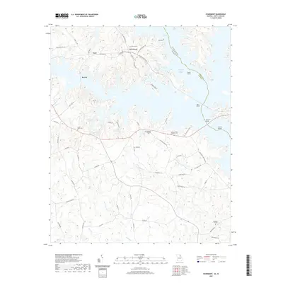
2020 Map of Heardmont
USGS Topo · Published 2020About this map
Heardmont and the surrounding Elbert County countryside are defined by the expansive waters of Richard B Russell Lake, which straddles the border between Georgia and South Carolina. This modern survey illustrates how the reservoir has reshaped the local geography, isolating landforms like Carter Island and Paris Island while submerging traditional river features such as Cherokee Shoals and Trotters Shoals. The landscape remains dotted with small family and community burial grounds, including the uniquely named Gods Acre Cem and Tucker Cem near the northern heights. Settlement patterns are concentrated along rural routes like Middleton Church Rd and Calhoun Falls Hwy, connecting the small communities of Pearl and Beverly. The abundance of established houses of worship and their associated grounds, such as Bethel Baptist Cem and Bethlehem Methodist Cem, points to the deep-rooted social fabric of this river-border region.
Find a feature on this map
70 named features on this map. Tap any name to fly to it.
Don’t see what you’re looking for? This feature index may not catch every label — zoom into the map to look around manually.
Map Details
Editions of this 2020 Heardmont Map
This is the sole edition of this map. No revisions or reprints were ever made.
Other maps of this area

1893 · Elberton
USGS Topo · 1:125,000

1906 · Crawfordville
USGS Topo · 1:125,000

1953 · Athens
USGS Topo · 1:250,000

1954 · Greenville
USGS Topo · 1:250,000

1955 · Broad
USGS Topo · 1:24,000

1955 · Chennault
USGS Topo · 1:24,000

1958 · Greenville
USGS Topo · 1:250,000

1958 · Athens
USGS Topo · 1:250,000

1958 · Elberton
USGS Topo · 1:62,500

1959 · Athens
USGS Topo · 1:250,000