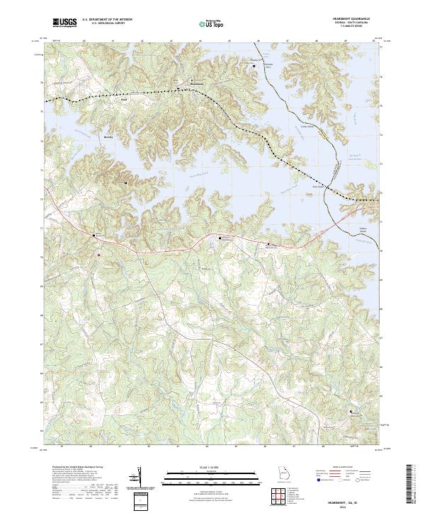
2024 Map of Heardmont
USGS Topo · Published 2024About this map
The Savannah River valley defines this borderland between Georgia and South Carolina, where the vast waters of Richard B Russell Lake have reshaped the historic geography of Elbert County. Small settlements like Heardmont, Pearl, and Beverly remain situated on the high ground above the reservoir's convoluted shoreline. The map reveals a landscape deeply connected to local genealogy, preserved through numerous burial sites including Gods Acre Cem, Bethel Grove Cem, and Bethlehem Methodist Cem.
Find a feature on this map
78 named features on this map. Tap any name to fly to it.
Don’t see what you’re looking for? This feature index may not catch every label — zoom into the map to look around manually.
Map Details
Editions of this 2024 Heardmont Map
This is the sole edition of this map. No revisions or reprints were ever made.
Other maps of this area

1893 · Elberton
USGS Topo · 1:125,000

1906 · Crawfordville
USGS Topo · 1:125,000

1953 · Athens
USGS Topo · 1:250,000

1954 · Greenville
USGS Topo · 1:250,000

1955 · Broad
USGS Topo · 1:24,000

1955 · Chennault
USGS Topo · 1:24,000

1958 · Greenville
USGS Topo · 1:250,000

1958 · Athens
USGS Topo · 1:250,000

1958 · Elberton
USGS Topo · 1:62,500

1959 · Athens
USGS Topo · 1:250,000