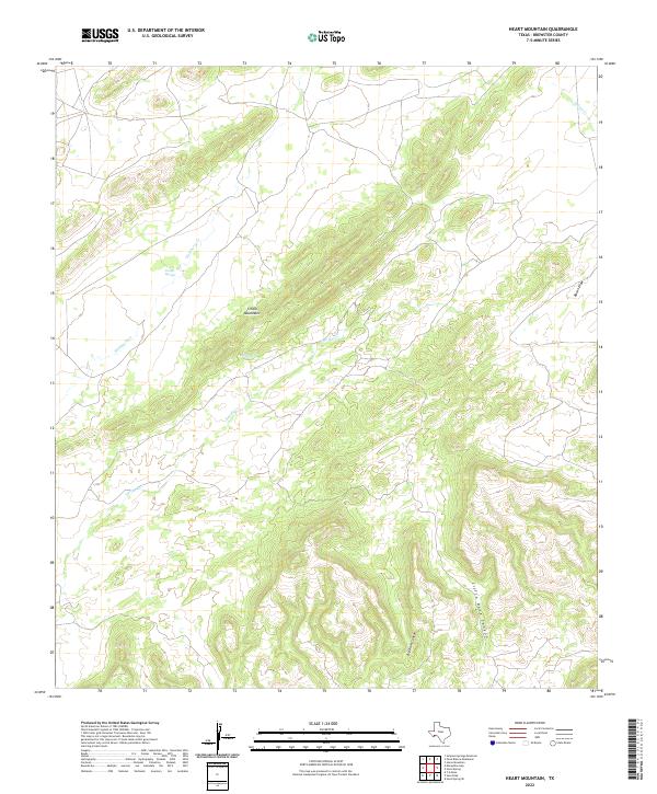
2022 Map of Heart Mountain
USGS Topo · Published 2022About this map
The Tinaja Mountains dominate this Brewster County landscape, where the high desert terrain is defined by a network of drainage systems and vital water sources. This 2022 survey documents critical water points such as Tinaja Springs and Tinaja Spring, names that suggest the natural rock basins or "tinajas" that collect rainwater in this arid environment. The complex topography is further marked by significant erosional features, including the deep cuts of Big Dark Canyon and Little Dark Canyon.
Find a feature on this map
9 named features on this map. Tap any name to fly to it.
Don’t see what you’re looking for? This feature index may not catch every label — zoom into the map to look around manually.
Map Details
Editions of this 2022 Heart Mountain Map
This is the sole edition of this map. No revisions or reprints were ever made.
Other maps of this area

1917 · Santiago Peak
USGS Topo · 1:62,500

1917 · Hood Spring
USGS Topo · 1:62,500

1918 · Bone Spring
USGS Topo · 1:125,000

1918 · Hood Spring
USGS Topo · 1:62,500

1918 · Santiago Peak
USGS Topo · 1:62,500

1920 · Monument Spring
USGS Topo · 1:62,500

1920 · Marathon
USGS Topo · 1:62,500

1921 · Monument Spring
USGS Topo · 1:62,500

1921 · Marathon
USGS Topo · 1:62,500

1931 · Hood Spring
USGS Topo · 1:62,500