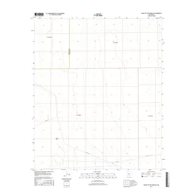
2017 Map of Heart of the Sands NE
USGS Topo · Published 2017About this map
Alkali Flat dominates the southwestern corner of this arid landscape, a vast dry lake bed that underscores the desert character of the Tularosa Basin. The map details a significant jurisdictional boundary between Doña Ana County and Otero County, cutting vertically through the western sections. This 2017 survey reveals the stark, sparse nature of the terrain, where infrastructure is limited to specialized routes like Wsmr P Rt 10. The absence of traditional settlements or townships highlights the area's role as part of the White Sands Missile Range, where the landscape remains largely defined by its natural topography and military-managed access corridors.
Find a feature on this map
7 named features on this map. Tap any name to fly to it.
Don’t see what you’re looking for? This feature index may not catch every label — zoom into the map to look around manually.
Map Details
Editions of this 2017 Heart of the Sands NE Map
This is the sole edition of this map. No revisions or reprints were ever made.
Other maps of this area

1916 · Tularosa
USGS Topo · 1:125,000

1916 · Point Of Sands
USGS Topo · 1:125,000

1947 · Point Of Sands 2
USGS Topo · 1:62,500

1948 · Lumley Lake
USGS Topo · 1:62,500

1948 · Tularosa
USGS Topo · 1:62,500

1948 · Holloman
USGS Topo · 1:62,500

1954 · Tularosa
USGS Topo · 1:250,000

1955 · Las Cruces
USGS Topo · 1:250,000

1958 · Las Cruces
USGS Topo · 1:250,000

1958 · Tularosa
USGS Topo · 1:250,000