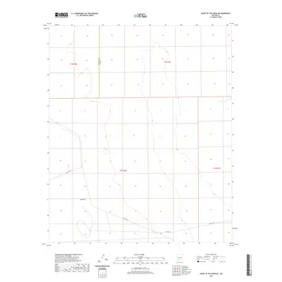
2020 Map of Heart of the Sands NE
USGS Topo · Published 2020About this map
Alkali Flat dominates this high-desert landscape on the border of Doña Ana and Otero counties, where the vast, white terrain reflects a unique geological environment. This 2020 survey records the sparse infrastructure of the White Sands Missile Range, specifically the route identified as WSMR P Rt 10. The map is primarily characterized by the township and range divisions of T15S R6E, T15S R7E, T16S R6E, and T16S R7E, illustrating the systematic grid layout of the American West across an otherwise desolate stretch of salt flats. Topographic contours reveal the subtle elevations of this basin, providing a detailed look at the basin floor before the terrain transitions into more dramatic desert landforms beyond the quadrangle's edges.
Find a feature on this map
7 named features on this map. Tap any name to fly to it.
Don’t see what you’re looking for? This feature index may not catch every label — zoom into the map to look around manually.
Map Details
Editions of this 2020 Heart of the Sands NE Map
This is the sole edition of this map. No revisions or reprints were ever made.
Other maps of this area

1916 · Tularosa
USGS Topo · 1:125,000

1916 · Point Of Sands
USGS Topo · 1:125,000

1947 · Point Of Sands 2
USGS Topo · 1:62,500

1948 · Lumley Lake
USGS Topo · 1:62,500

1948 · Tularosa
USGS Topo · 1:62,500

1948 · Holloman
USGS Topo · 1:62,500

1954 · Tularosa
USGS Topo · 1:250,000

1955 · Las Cruces
USGS Topo · 1:250,000

1958 · Las Cruces
USGS Topo · 1:250,000

1958 · Tularosa
USGS Topo · 1:250,000