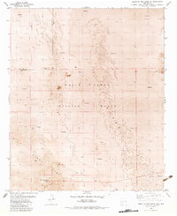
1982 Map of Heart of the Sands NE
USGS Topo · Published 1982About this map
White Sands Missile Range dominates this orthophotomosaic, where the stark desert geography of the Tularosa Basin is recorded with precision. The landscape is characterized by the expansive Alkali Flat and numerous deposits of Shifting Sand that migrate across the basin floor. This map, edited in 1982, reveals a specialized military environment where remote technical installations such as Ratscat and a Radio Tower sit alongside a solitary Water Tank and a network of Jeep Trails. The boundary between Doña Ana and Otero counties cuts through the northern portion of the sheet, providing a administrative framework for this otherwise unpopulated terrain. The orthophotomosaic format is particularly useful here, as it preserves the visual textures of the dunes and flats that topographic lines alone cannot fully convey.
Find a feature on this map
8 named features on this map. Tap any name to fly to it.
Don’t see what you’re looking for? This feature index may not catch every label — zoom into the map to look around manually.
Map Details
Editions of this 1982 Heart of the Sands NE Map
This is the sole edition of this map. No revisions or reprints were ever made.
Other maps of this area

1916 · Tularosa
USGS Topo · 1:125,000

1916 · Point Of Sands
USGS Topo · 1:125,000

1947 · Point Of Sands 2
USGS Topo · 1:62,500

1948 · Lumley Lake
USGS Topo · 1:62,500

1948 · Tularosa
USGS Topo · 1:62,500

1948 · Holloman
USGS Topo · 1:62,500

1954 · Tularosa
USGS Topo · 1:250,000

1955 · Las Cruces
USGS Topo · 1:250,000

1958 · Las Cruces
USGS Topo · 1:250,000

1958 · Tularosa
USGS Topo · 1:250,000