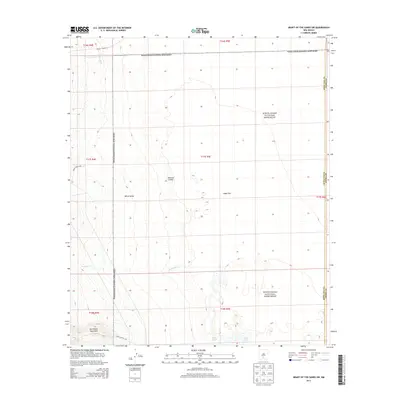
2013 Map of Heart of the Sands SW
USGS Topo · Published 2013About this map
White Sands National Monument dominates this desert landscape in southern New Mexico, where the floor of the Tularosa Valley meets the eastern foothills of the San Andres Mountains. The map reveals the intricate drainage and hydrology of this arid basin, centered on the expansive Alkali Flat and the saline waters of Lake Lucero. Intermittent watercourses like Andrecito Cr flow from the western highlands toward the white gypsum dunes of White Sands, illustrating the internal drainage patterns typical of this region. Restricted access roads, including WSMR S Route 289 and WSMR P Route 10, point to the area's ongoing use for military testing and government research within the White Sands Missile Range, providing a detailed look at the interface between protected natural wonders and strategic national infrastructure.
Find a feature on this map
10 named features on this map. Tap any name to fly to it.
Don’t see what you’re looking for? This feature index may not catch every label — zoom into the map to look around manually.
Map Details
Editions of this 2013 Heart of the Sands SW Map
This is the sole edition of this map. No revisions or reprints were ever made.
Other maps of this area

1916 · Tonuco
USGS Topo · 1:125,000

1916 · Point Of Sands
USGS Topo · 1:125,000

1932 · Tonuco
USGS Topo · 1:125,000

1947 · Point Of Sands 2
USGS Topo · 1:62,500

1947 · Lake Lucero
USGS Topo · 1:62,500

1948 · Bear Peak
USGS Topo · 1:62,500

1948 · Kaylor Mountain
USGS Topo · 1:62,500

1948 · Lake Lucero
USGS Topo · 1:24,000
1950 · Lake Lucero
USGS Topo · 1:24,000
1950 · Lake Lucero NE
USGS Topo · 1:24,000