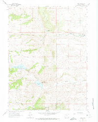
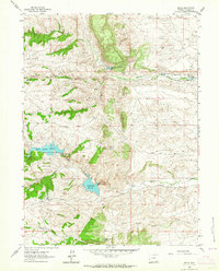
1962 Map of Hecla
USGS Topo · Published 1974About this map
Water management and resource extraction define this Laramie County landscape, dominated by the massif of Table Mountain. By the early 1960s, a complex system of reservoirs and transit infrastructure had been established to manage the various forks of Crow Creek. Key features include the Granite Springs Reservoir, Crystal Lake Reservoir, and the North Crow Diversion Reservoir, which are linked by the Whitney Ditch and a dedicated Aqueduct. This network illustrates the critical importance of water storage for the high plains and nearby Cheyenne.
Find a feature on this map
27 named features on this map. Tap any name to fly to it.
Don’t see what you’re looking for? This feature index may not catch every label — zoom into the map to look around manually.
Map Details
Editions of this 1962 Hecla Map
4 editions found
Other maps of this area

1905 · Sherman
USGS Topo · 1:125,000

1948 · Sherman Mountains
USGS Topo · 1:62,500

1948 · Ragged Top Mountain
USGS Topo · 1:62,500

1950 · Ragged Top Mountain
USGS Topo · 1:62,500

1950 · Sherman Mountains
USGS Topo · 1:62,500

1954 · Cheyenne
USGS Topo · 1:250,000

1958 · Cheyenne
USGS Topo · 1:250,000

1962 · Federal
USGS Topo · 1:24,000
1962 · Silver Crown
USGS Topo · 1:24,000
1962 · Hecla
USGS Topo · 1:24,000