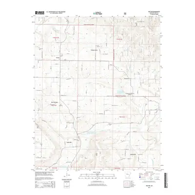
2014 Map of Hector
USGS Topo · Published 2014About this map
Hector serves as the central hub of this Pope County landscape, where the street grid of Elm St, Pine St, and Maple St meets State Hwy 27. To the north, the terrain rises into the Ozark National Forest, defined by significant elevations like White Oak Mtn and the historic Peterman Lookout Tower. The settlement pattern follows the drainage of the Illinois Bayou and its many tributaries, including Dare Cr and Clear Cr.
Find a feature on this map
96 named features on this map. Tap any name to fly to it.
Don’t see what you’re looking for? This feature index may not catch every label — zoom into the map to look around manually.
Map Details
Editions of this 2014 Hector Map
This is the sole edition of this map. No revisions or reprints were ever made.
Other maps of this area

1879 · Washington
USGS Topo · 1:62,500

1887 · Smyrna
USGS Topo · 1:62,500

1888 · Dardanelle #1
USGS Topo · 1:62,500

1889 · Treat
USGS Topo · 1:62,500

1889 · Marshall #3
USGS Topo · 1:62,500

1890 · Dardanelle
USGS Topo · 1:125,000

1892 · Marshall
USGS Topo · 1:125,000

1892 · Morrillton
USGS Topo · 1:125,000

1894 · Morrillton
USGS Topo · 1:125,000

1894 · Marshall
USGS Topo · 1:125,000