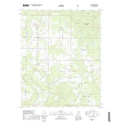
2020 Map of Hector
USGS Topo · Published 2020About this map
Hector and surrounding Pope County settlements like Caglesville, Welcome, and Buttermilk are defined by a complex network of creeks and prominent ridges. The landscape is marked by substantial vertical relief, with White Oak Mtn to the north and Buck Mtn and Iron Ore Mtn further south. This area includes a significant portion of the Ozark National Forest, where steep drainages for Hurricane Cr and Bradley Cr cut through the timberland. Family and community history is anchored by numerous burial grounds throughout the countryside, including the Campground Cem and Walnut Grove Cem. Local infrastructure is characterized by winding secondary roads like Stafford Rd and Iron Ore Mtn Rd, reflecting the area's agricultural and forest-service roots. Water resources are plentiful, ranging from the Illinois Bayou to the West-Fork-Point-Remove-Cr Site 10 Reservoir, illustrating the varied hydrography of this Ozark foothills region.
Find a feature on this map
69 named features on this map. Tap any name to fly to it.
Don’t see what you’re looking for? This feature index may not catch every label — zoom into the map to look around manually.
Map Details
Editions of this 2020 Hector Map
This is the sole edition of this map. No revisions or reprints were ever made.
Other maps of this area

1879 · Washington
USGS Topo · 1:62,500

1887 · Smyrna
USGS Topo · 1:62,500

1888 · Dardanelle #1
USGS Topo · 1:62,500

1889 · Treat
USGS Topo · 1:62,500

1889 · Marshall #3
USGS Topo · 1:62,500

1890 · Dardanelle
USGS Topo · 1:125,000

1892 · Marshall
USGS Topo · 1:125,000

1892 · Morrillton
USGS Topo · 1:125,000

1894 · Morrillton
USGS Topo · 1:125,000

1894 · Marshall
USGS Topo · 1:125,000