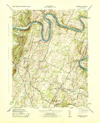
1944 Map of Hedgesville
USGS Topo · Published 1944About this map
The Potomac River carves a dramatic path through the landscape between Maryland and West Virginia, most notably at the sharp horseshoe bend known as The Neck. This mid-century survey documents a region defined by industrial and agricultural transport, where the Chesapeake and Ohio Canal and Western Maryland RR parallel the northern riverbank. To the south, the industrial infrastructure of the North American Cement Company and the Cumbo Yard rail interchange indicate the era's heavy reliance on rail and raw material extraction.
Find a feature on this map
47 named features on this map. Tap any name to fly to it.
Don’t see what you’re looking for? This feature index may not catch every label — zoom into the map to look around manually.
Map Details
Editions of this 1944 Hedgesville Map
This is the sole edition of this map. No revisions or reprints were ever made.
Other maps of this area

1884 · Harpers Ferry
USGS Topo · 1:125,000

1891 · Harpers Ferry
USGS Topo · 1:125,000

1893 · Harpers Ferry
USGS Topo · 1:125,000

1894 · Winchester
USGS Topo · 1:125,000

1899 · Hancock
USGS Topo · 1:62,500

1901 · Hancock
USGS Topo · 1:62,500

1912 · Williamsport
USGS Topo · 1:62,500

1914 · Martinsburg
USGS Topo · 1:48,000

1914 · Gerrardstown
USGS Topo · 1:48,000

1916 · Gerrardstown
USGS Topo · 1:62,500