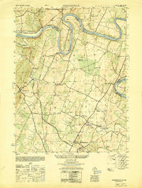
1949 Map of Hedgesville
USGS Topo · Published 1949About this map
The Potomac River carves a dramatic serpentine path through this 1940s landscape, serving as the border between West Virginia and Maryland. Along its northern bank, the Chesapeake and Ohio Canal is a prominent fixture, passing through Four Locks and near the historic grounds of Fort Frederick State Park. This era finds the region defined by a mix of heavy industry and vast orchard operations. The North American Cement Company and the rail hub at Cumbo Yard anchor the southern industrial sector, while the Cumberland Valley Orchards Packing House and Arcadia Orchards Packing House speak to the agricultural economy centered around Hedgesville. Local landmarks like the Stonewall Jackson Monument and Indian Church Cave add specific historical character to the terrain of North Mountain.
Find a feature on this map
50 named features on this map. Tap any name to fly to it.
Don’t see what you’re looking for? This feature index may not catch every label — zoom into the map to look around manually.
Map Details
Editions of this 1949 Hedgesville Map
This is the sole edition of this map. No revisions or reprints were ever made.
Other maps of this area

1884 · Harpers Ferry
USGS Topo · 1:125,000

1891 · Harpers Ferry
USGS Topo · 1:125,000

1893 · Harpers Ferry
USGS Topo · 1:125,000

1894 · Winchester
USGS Topo · 1:125,000

1899 · Hancock
USGS Topo · 1:62,500

1901 · Hancock
USGS Topo · 1:62,500

1912 · Williamsport
USGS Topo · 1:62,500

1914 · Martinsburg
USGS Topo · 1:48,000

1914 · Gerrardstown
USGS Topo · 1:48,000

1916 · Gerrardstown
USGS Topo · 1:62,500