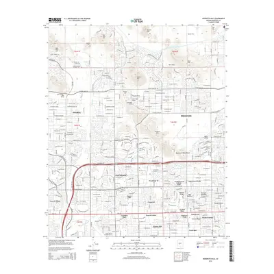
2014 Map of Hedgpeth Hills
USGS Topo · Published 2014About this map
The Hedgpeth Hills and neighboring Deem Hills define the northern desert landscape of the Salt River Valley as suburban development pushes into the mountain shadows. This 2014 survey records the expansion of Phoenix, Peoria, and Glendale at a time when residential subdivisions like Suncrest Villas West and Peacock Village were filling in formerly open spaces near the New River. The infrastructure of the Central Arizona Project Aqueduct is visible cutting through Weir Valley, a critical lifeline for this arid region. Significant educational and topographic landmarks are documented throughout, from Midwestern Univ in the south to the prominent peaks of West Wing Mtn and East Wing Mtn in the north, providing a detailed look at the interface between the Sonoran Desert and the modern metropolitan sprawl.
Find a feature on this map
54 named features on this map. Tap any name to fly to it.
Don’t see what you’re looking for? This feature index may not catch every label — zoom into the map to look around manually.
Map Details
Editions of this 2014 Hedgpeth Hills Map
This is the sole edition of this map. No revisions or reprints were ever made.
Other maps of this area

1954 · Phoenix
USGS Topo · 1:250,000

1957 · Phoenix
USGS Topo · 1:250,000

1957 · Calderwood Butte
USGS Topo · 1:24,000

1957 · El Mirage
USGS Topo · 1:24,000

1957 · Hedgpeth Hills
USGS Topo · 1:24,000

1957 · Glendale
USGS Topo · 1:24,000

1958 · Phoenix
USGS Topo · 1:250,000

1960 · Phoenix
USGS Topo · 1:250,000
1964 · Baldy Mtn
USGS Topo · 1:24,000
1964 · New River SE
USGS Topo · 1:24,000