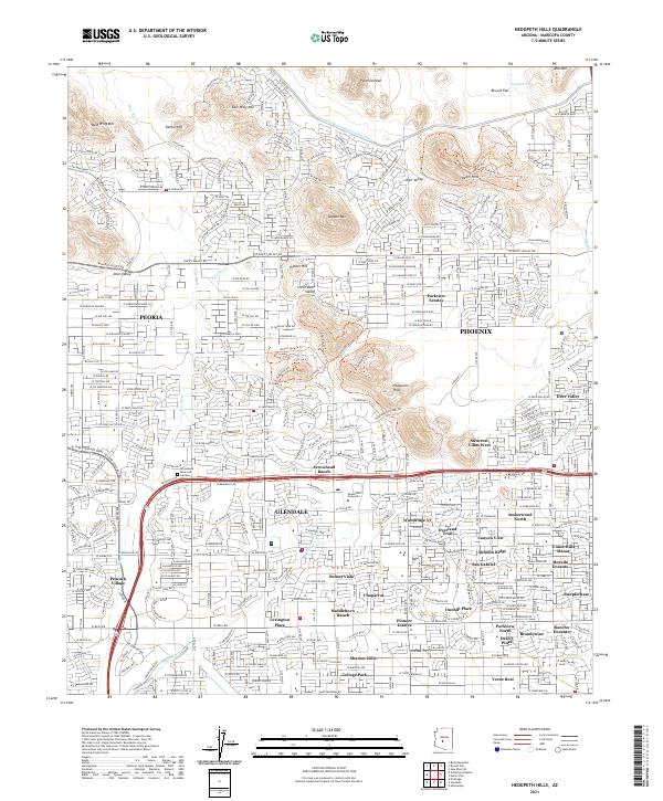
2021 Map of Hedgpeth Hills
USGS Topo · Published 2021About this map
Phoenix, Glendale, and Peoria converge in this densely developed region of the northern Salt River Valley. The landscape is defined by the intersection of master-planned residential communities and prominent desert landforms. Large-scale water management is central to the area's layout, anchored by the Central Arizona Project Aqueduct and the intermittent flows of the New River and Skunk Creek.
Find a feature on this map
71 named features on this map. Tap any name to fly to it.
Don’t see what you’re looking for? This feature index may not catch every label — zoom into the map to look around manually.
Map Details
Editions of this 2021 Hedgpeth Hills Map
This is the sole edition of this map. No revisions or reprints were ever made.
Other maps of this area

1954 · Phoenix
USGS Topo · 1:250,000

1957 · Phoenix
USGS Topo · 1:250,000

1957 · Calderwood Butte
USGS Topo · 1:24,000

1957 · El Mirage
USGS Topo · 1:24,000

1957 · Hedgpeth Hills
USGS Topo · 1:24,000

1957 · Glendale
USGS Topo · 1:24,000

1958 · Phoenix
USGS Topo · 1:250,000

1960 · Phoenix
USGS Topo · 1:250,000
1964 · Baldy Mtn
USGS Topo · 1:24,000
1964 · New River SE
USGS Topo · 1:24,000