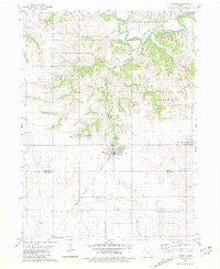
1980 Map of Hedrick
USGS Topo · Published 1981About this map
Hedrick serves as the central hub of this southeastern Iowa landscape, where the Chicago Milwaukee St Paul and Pacific railroad creates a distinct diagonal path across the Keokuk and Wapello county line. The terrain transitions from the broad agricultural flats around Martinsburg and Highland Center to the more dissected drainage basins of the South Skunk River in the north. This variation in topography is reflected in the placement of several family-named burial grounds, including Akerman Cem, Abel Cem, and Brooks Cem, which are often situated on the higher ground overlooking small tributaries like Sugar Creek and Steady Run. A small Quarry near Gobbler Creek indicates localized industrial activity, while the intricate network of section roads reveals a well-established rural infrastructure surrounding the township boundaries of Benton and Competine.
Find a feature on this map
26 named features on this map. Tap any name to fly to it.
Don’t see what you’re looking for? This feature index may not catch every label — zoom into the map to look around manually.
Map Details
Editions of this 1980 Hedrick Map
This is the sole edition of this map. No revisions or reprints were ever made.
Other maps of this area

1954 · Des Moines
USGS Topo · 1:250,000

1956 · Des Moines
USGS Topo · 1:250,000

1956 · Farson
USGS Topo · 1:24,000

1956 · Ottumwa North
USGS Topo · 1:62,500

1956 · Ottumwa North
USGS Topo · 1:24,000

1957 · Des Moines
USGS Topo · 1:250,000

1965 · Rose Hill
USGS Topo · 1:24,000

1965 · Sigourney
USGS Topo · 1:24,000

1965 · Delta
USGS Topo · 1:24,000

1969 · Des Moines
USGS Topo · 1:250,000