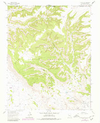
1963 Map of Heifer Point
USGS Topo · Published 1980About this map
Ute Mountain Indian Reservation land dominates this high-desert landscape on the border of Colorado and New Mexico, where deep drainages like Salt Canyon and Straight Canyon carve through the plateau. The topography is defined by the prominent Heifer Point and a series of arroyos, including Shumway Arroyo and Eagle Nest Arroyo, that channel water during the infrequent but heavy rains of the Four Corners region.
Find a feature on this map
26 named features on this map. Tap any name to fly to it.
Don’t see what you’re looking for? This feature index may not catch every label — zoom into the map to look around manually.
Map Details
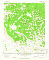
Editions of this 1963 Heifer Point Map
2 editions found
Other maps of this area

1889 · Chaco
USGS Topo · 1:250,000

1892 · Chaco
USGS Topo · 1:250,000

1912 · Soda Canyon
USGS Topo · 1:62,500

1915 · Soda Canyon
USGS Topo · 1:62,500

1934 · Chimney Rock
USGS Topo · 1:62,500

1936 · Chimney Rock
USGS Topo · 1:62,500

1954 · Shiprock
USGS Topo · 1:250,000

1956 · Cortez
USGS Topo · 1:250,000

1958 · Cortez
USGS Topo · 1:250,000

1958 · Shiprock
USGS Topo · 1:250,000