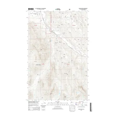
2014 Map of Helena Ridge
USGS Topo · Published 2014About this map
Darrington anchors the northern edge of this survey, serving as a gateway to the high elevations of the Mount Baker National Forest. The landscape is dominated by the steep drainage of the Sauk River, where the Mountain Loop Hwy follows the riverbank past the Clear Creek Campground. The map reveals a complex network of glacial cirques and alpine basins, including the remote Cedar Basin and numerous high-altitude water bodies such as Lake Angeline, Helena Lake, and Vindom Lake.
Find a feature on this map
39 named features on this map. Tap any name to fly to it.
Don’t see what you’re looking for? This feature index may not catch every label — zoom into the map to look around manually.
Map Details
Editions of this 2014 Helena Ridge Map
This is the sole edition of this map. No revisions or reprints were ever made.
Other maps of this area

1899 · Glacier Peak
USGS Topo · 1:125,000

1899 · Stillaguamish
USGS Topo · 1:125,000

1901 · Glacier Peak
USGS Topo · 1:125,000

1901 · Stilaguamish
USGS Topo · 1:125,000

1955 · Concrete
USGS Topo · 1:250,000

1957 · Silverton
USGS Topo · 1:62,500

1958 · Concrete
USGS Topo · 1:250,000

1962 · Concrete
USGS Topo · 1:250,000
1966 · Darrington
USGS Topo · 1:24,000
1966 · Bedal
USGS Topo · 1:24,000