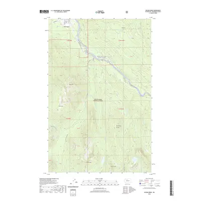
2020 Map of Helena Ridge
USGS Topo · Published 2020About this map
Darrington sits at the edge of the Mount Baker National Forest, serving as a gateway to the steep, high-elevation terrain of Snohomish County. The northern edge of the map features the village's street grid, including Commercial Ave and Niederprum Rd, before the landscape rises sharply into the peaks of the North Cascades. The Skagit Wild and Scenic River corridor dominates the central valley, providing a natural path for the Old Sauk Trail and the Mountain Loop Hwy.
Find a feature on this map
56 named features on this map. Tap any name to fly to it.
Don’t see what you’re looking for? This feature index may not catch every label — zoom into the map to look around manually.
Map Details
Editions of this 2020 Helena Ridge Map
This is the sole edition of this map. No revisions or reprints were ever made.
Other maps of this area

1899 · Glacier Peak
USGS Topo · 1:125,000

1899 · Stillaguamish
USGS Topo · 1:125,000

1901 · Glacier Peak
USGS Topo · 1:125,000

1901 · Stilaguamish
USGS Topo · 1:125,000

1955 · Concrete
USGS Topo · 1:250,000

1957 · Silverton
USGS Topo · 1:62,500

1958 · Concrete
USGS Topo · 1:250,000

1962 · Concrete
USGS Topo · 1:250,000
1966 · Darrington
USGS Topo · 1:24,000
1966 · Bedal
USGS Topo · 1:24,000