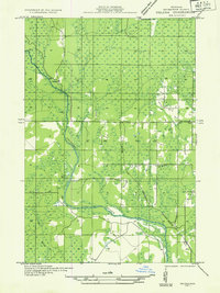
1932 Map of Helena SE
USGS Topo · Published 1932About this map
The Chicago and Northwestern railroad and the Escanaba River define the development of this northern Michigan landscape during the early 1930s. This survey, compiled from early Air Corps aerial photography, captures a transition in land use within the township of Ewing. While the presence of Sherkeys Camp and Finn Camp suggests a history tied to seasonal labor or logging, the establishment of the Town Hall Sch, Ewing Sch No 1, and Lincoln Sch indicates a maturing community of permanent settlers. The network of section lines and secondary roads reveals how residents navigated the wetlands around Hunter's Brook and the Beaver Branch of the river. The map's detail provides a unique look at the rural infrastructure of Marquette County before the widespread modernization of the mid-20th century.
Find a feature on this map
13 named features on this map. Tap any name to fly to it.
Don’t see what you’re looking for? This feature index may not catch every label — zoom into the map to look around manually.
Map Details
Editions of this 1932 Helena SE Map
2 editions found
Other maps of this area

1932 · Rock SW
USGS Topo · 1:31,680

1932 · Helena NW
USGS Topo · 1:31,680

1932 · Helena NE
USGS Topo · 1:31,680

1932 · Whitney NE
USGS Topo · 1:31,680

1932 · Helena SW
USGS Topo · 1:31,680

1932 · Rock NW
USGS Topo · 1:31,680

1932 · Helena
USGS Topo · 1:31,680

1932 · Gladstone NW
USGS Topo · 1:31,680

1950 · Gladstone NW
USGS Topo · 1:31,680

1951 · Helena SW
USGS Topo · 1:31,680