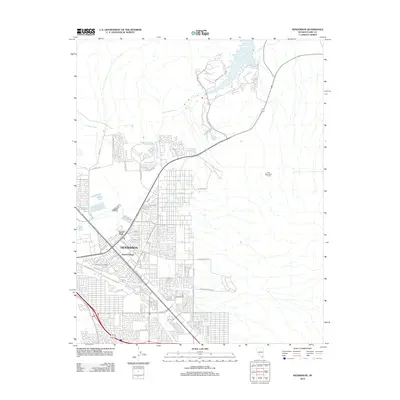
2012 Map of Henderson
USGS Topo · Published 2012About this map
Henderson shows a densely organized urban grid transitioning into the Mojave landscape just south of the Las Vegas Wash. This early 21st-century view documents the significant residential expansion of the area, centered around the historic core and the Henderson Post Office. Notable residential developments such as Victory Village and Las Vegas Downs illustrate the city's mid-to-late century growth patterns. The map highlights the intersection of modern infrastructure and natural topography, with the River Mountains Tunnel cutting through the terrain to the east. Public spaces like Carver Park and major thoroughfares including N Water St and Burkholder Blvd define the social and transit layout of the community during this period of Nevada's rapid urbanization.
Find a feature on this map
54 named features on this map. Tap any name to fly to it.
Don’t see what you’re looking for? This feature index may not catch every label — zoom into the map to look around manually.
Map Details
Editions of this 2012 Henderson Map
This is the sole edition of this map. No revisions or reprints were ever made.
Other maps of this area

1886 · Camp Mohave
USGS Topo · 1:250,000

1886 · Saint Thomas
USGS Topo · 1:250,000

1892 · Camp Mohave
USGS Topo · 1:250,000

1893 · Saint Thomas
USGS Topo · 1:250,000

1907 · Las Vegas
USGS Topo · 1:250,000

1908 · Las Vegas
USGS Topo · 1:250,000

1910 · Ivanpah
USGS Topo · 1:250,000

1912 · Ivanpah
USGS Topo · 1:250,000

1926 · Nelson
USGS Topo · 1:96,000

1926 · Boulder Canyon
USGS Topo · 1:96,000