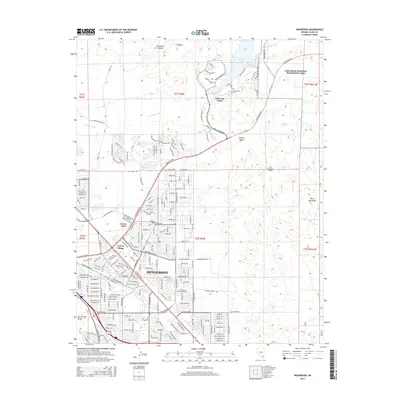
2015 Map of Henderson
USGS Topo · Published 2015About this map
Henderson anchors this 2015 study of Clark County's suburban development and desert terrain. The map captures the dense street grids of neighborhood enclaves like Victory Village and Carver Park as they meet the expansive Mojave Desert. This era shows a community in transition, where residential expansion is checked by the dramatic natural boundaries of the McCullough Range and the River Mountains. A primary hydrological feature is the Las Vegas Wash, which feeds into Lake Las Vegas, a major residential and recreational center in the northeast. The map also delineates the western edge of the Lake Mead National Recreation Area, showing how civil engineering projects like the River Mountains Tunnel and major thoroughfares such as E Lake Mead Pky and the S Boulder Hwy facilitate movement through this arid landscape.
Find a feature on this map
28 named features on this map. Tap any name to fly to it.
Don’t see what you’re looking for? This feature index may not catch every label — zoom into the map to look around manually.
Map Details
Editions of this 2015 Henderson Map
This is the sole edition of this map. No revisions or reprints were ever made.
Other maps of this area

1886 · Camp Mohave
USGS Topo · 1:250,000

1886 · Saint Thomas
USGS Topo · 1:250,000

1892 · Camp Mohave
USGS Topo · 1:250,000

1893 · Saint Thomas
USGS Topo · 1:250,000

1907 · Las Vegas
USGS Topo · 1:250,000

1908 · Las Vegas
USGS Topo · 1:250,000

1910 · Ivanpah
USGS Topo · 1:250,000

1912 · Ivanpah
USGS Topo · 1:250,000

1926 · Nelson
USGS Topo · 1:96,000

1926 · Boulder Canyon
USGS Topo · 1:96,000