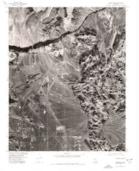
1973 Map of Henderson
USGS Topo · Published 1977About this map
Union Pacific rail lines cut through this arid landscape, serving as a primary corridor for transportation and industrial growth in the early 1970s. This orthophotograph, derived from aerial imagery captured in 1973, reveals the sharp contrast between the burgeoning suburban layout of Henderson and the surrounding Mojave Desert terrain. The Las Vegas Wash is visible as a prominent drainage feature carving through the valley toward the east, while the complex geological formations of Rainbow Gardens dominate the northern portion of the sheet. Unlike standard topographic maps, this orthophotoquad provides a literal visual record of land use, showing the precise footprints of residential blocks, industrial sites, and the sparse vegetation of the desert floor during a period of rapid development in Clark County.
Find a feature on this map
3 named features on this map. Tap any name to fly to it.
Don’t see what you’re looking for? This feature index may not catch every label — zoom into the map to look around manually.
Map Details
Editions of this 1973 Henderson Map
This is the sole edition of this map. No revisions or reprints were ever made.
Other maps of this area

1886 · Camp Mohave
USGS Topo · 1:250,000

1886 · Saint Thomas
USGS Topo · 1:250,000

1892 · Camp Mohave
USGS Topo · 1:250,000

1893 · Saint Thomas
USGS Topo · 1:250,000

1907 · Las Vegas
USGS Topo · 1:250,000

1908 · Las Vegas
USGS Topo · 1:250,000

1910 · Ivanpah
USGS Topo · 1:250,000

1912 · Ivanpah
USGS Topo · 1:250,000

1926 · Nelson
USGS Topo · 1:96,000

1926 · Boulder Canyon
USGS Topo · 1:96,000