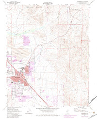
1970 Map of Henderson
USGS Topo · Published 1983About this map
Henderson occupies the heart of this Nevada landscape, showing the town's industrial and residential expansion during the mid-twentieth century. The map highlights the significant role of large-scale industry, with the Three Kids Mine and expansive Tailings Ponds dominating the northern sector. Residential pockets such as Carver Park and various trailer parks are woven between the Union Pacific and Pacific RR lines, illustrating the town's origins as a desert hub for wartime magnesium production and later chemical manufacturing.
Find a feature on this map
38 named features on this map. Tap any name to fly to it.
Don’t see what you’re looking for? This feature index may not catch every label — zoom into the map to look around manually.
Map Details
Editions of this 1970 Henderson Map
4 editions found
Other maps of this area

1886 · Camp Mohave
USGS Topo · 1:250,000

1886 · Saint Thomas
USGS Topo · 1:250,000

1892 · Camp Mohave
USGS Topo · 1:250,000

1893 · Saint Thomas
USGS Topo · 1:250,000

1907 · Las Vegas
USGS Topo · 1:250,000

1908 · Las Vegas
USGS Topo · 1:250,000

1910 · Ivanpah
USGS Topo · 1:250,000

1912 · Ivanpah
USGS Topo · 1:250,000

1926 · Nelson
USGS Topo · 1:96,000

1926 · Boulder Canyon
USGS Topo · 1:96,000