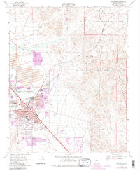
1970 Map of Henderson
USGS Topo · Published 1983About this map
Henderson emerges as a growing industrial and residential center during this transition from the 1960s into the early 1980s. The map captures a landscape defined by its heavy industry and infrastructure, notably the massive Tailings Ponds and the Three Kids Mine to the east. Urban development is centered around the Boulder Highway corridor, with established neighborhoods like Carver Park and essential local landmarks such as the Rose de Lima Hosp and Basic High Sch.
Find a feature on this map
58 named features on this map. Tap any name to fly to it.
Don’t see what you’re looking for? This feature index may not catch every label — zoom into the map to look around manually.
Map Details
Editions of this 1970 Henderson Map
4 editions found
Other maps of this area

1886 · Camp Mohave
USGS Topo · 1:250,000

1886 · Saint Thomas
USGS Topo · 1:250,000

1892 · Camp Mohave
USGS Topo · 1:250,000

1893 · Saint Thomas
USGS Topo · 1:250,000

1907 · Las Vegas
USGS Topo · 1:250,000

1908 · Las Vegas
USGS Topo · 1:250,000

1910 · Ivanpah
USGS Topo · 1:250,000

1912 · Ivanpah
USGS Topo · 1:250,000

1926 · Nelson
USGS Topo · 1:96,000

1926 · Boulder Canyon
USGS Topo · 1:96,000