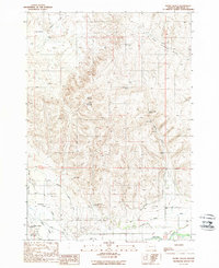
1988 Map of Henry Gulch
USGS Topo · Published 1988About this map
Malheur River bottomlands and an intricate system of irrigation infrastructure define this late-twentieth-century landscape in Malheur County. The southern portion of the map reveals the critical importance of water management in the high desert, featuring the Owyhee Canal, the Gellerman-Froman Canal, and the Warm Springs Pump Canal as they navigate the terrain near Willow Creek. A small Cem is located near the junction of Hope Dr and the canals, providing a specific point of interest for genealogists and local historians researching the Gellerman and Hope areas.
Find a feature on this map
29 named features on this map. Tap any name to fly to it.
Don’t see what you’re looking for? This feature index may not catch every label — zoom into the map to look around manually.
Map Details
Editions of this 1988 Henry Gulch Map
This is the sole edition of this map. No revisions or reprints were ever made.
Other maps of this area

1906 · Mitchell Butte
USGS Topo · 1:125,000

1950 · Jamieson
USGS Topo · 1:62,500

1951 · Moores Hollow
USGS Topo · 1:24,000

1951 · Malheur Butte
USGS Topo · 1:24,000

1951 · Moores Hollow
USGS Topo · 1:62,500

1955 · Baker
USGS Topo · 1:250,000

1955 · Boise
USGS Topo · 1:250,000

1958 · Boise
USGS Topo · 1:250,000

1959 · Baker
USGS Topo · 1:250,000

1962 · Boise
USGS Topo · 1:250,000