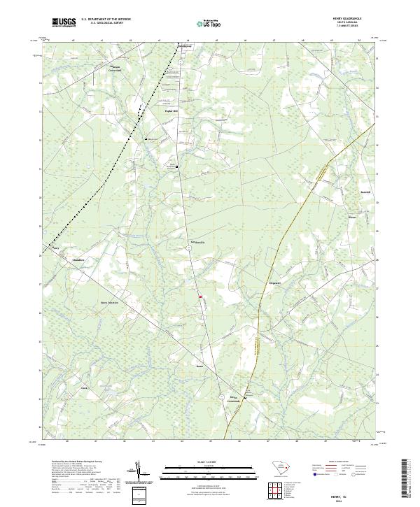
2024 Map of Henry
USGS Topo · Published 2024About this map
Black Mingo Creek and its complex network of tributaries, including Snow Branch and Rome Branch, define the low-lying geography of this portion of Williamsburg County and Georgetown County. The landscape is characterized by extensive wetlands like Indiantown Swamp and Campbell Swamp, which have historically shaped the placement of roads and small settlements. Local transit and community life center around rural junctions such as Snow Junction, Brunson Crossroads, and Union Crossroads. Genealogists will find significant value in the detailed identification of religious and burial sites, notably the Poplar Hill Church & Graveyard and Union Church & Graveyard, as well as the family-named Harmon Cem. This mapping captures the persistence of small communities like Rome, Hemingway, and Gordonville within a terrain dominated by timber and water.
Find a feature on this map
115 named features on this map. Tap any name to fly to it.
Don’t see what you’re looking for? This feature index may not catch every label — zoom into the map to look around manually.
Map Details
Editions of this 2024 Henry Map
This is the sole edition of this map. No revisions or reprints were ever made.
Other maps of this area

1943 · Henry
USGS Topo · 1:24,000

1943 · Carvers Bay
USGS Topo · 1:24,000

1943 · Rhems
USGS Topo · 1:24,000

1943 · Outland
USGS Topo · 1:24,000

1944 · Outland
USGS Topo · 1:31,680

1946 · Hyman
USGS Topo · 1:62,500

1946 · Johnsonville
USGS Topo · 1:62,500

1946 · Indiantown
USGS Topo · 1:62,500

1949 · Georgetown
USGS Topo · 1:250,000

1967 · Georgetown
USGS Topo · 1:250,000