
1972 Map of Hereford
USGS Topo · Published 1975About this map
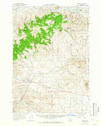
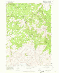
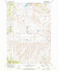
Burnt River Valley dominates the northern portion of this landscape, where the settlement of Hereford sits along the Burnt River. The map reveals a complex network of water management and upland access routes, including the Eldorado Ditch and numerous named springs such as Hamer Spring and Tyrell Spring. The terrain transitions from the river bottom to prominent peaks like Murray Peak and Rock Creek Butte, intersected by the Happy Camp Trail and various unnamed jeep trails that navigate the high country.
Find a feature on this map
34 named features on this map. Tap any name to fly to it.
Don’t see what you’re looking for? This feature index may not catch every label — zoom into the map to look around manually.
Map Details
Editions of this 1972 Hereford Map
This is the sole edition of this map. No revisions or reprints were ever made.
Other maps of this area

1901 · Baker City
USGS Topo · 1:125,000

1901 · Sumpter
USGS Topo · 1:125,000

1908 · Ironside Mountain
USGS Topo · 1:125,000

1955 · Baker
USGS Topo · 1:250,000

1955 · Canyon City
USGS Topo · 1:250,000

1959 · Baker
USGS Topo · 1:250,000

1959 · Canyon City
USGS Topo · 1:250,000
1964 · Ironside
USGS Topo · 1:62,500
1967 · Brannan Gulch
USGS Topo · 1:24,000
1972 · Unity
USGS Topo · 1:24,000