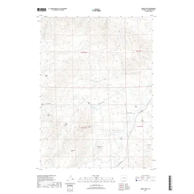
2017 Map of Hermit Rock
USGS Topo · Published 2017About this map
Windy Ridge and Hatterman Hill dominate this portion of the Wyoming landscape, where the high plains transition into a complex network of draws and creek beds. The drainage pattern is defined by La Prele Cr and the waters of La Prele Reservoir, while isolated landmarks like Hermit Rock and Round Hill provide distinct navigational points for those tracing old ranching boundaries or local topography.
Find a feature on this map
41 named features on this map. Tap any name to fly to it.
Don’t see what you’re looking for? This feature index may not catch every label — zoom into the map to look around manually.
Map Details
Editions of this 2017 Hermit Rock Map
This is the sole edition of this map. No revisions or reprints were ever made.
Other maps of this area

1949 · Orpha
USGS Topo · 1:24,000

1949 · Careyhurst
USGS Topo · 1:24,000

1949 · Glenrock
USGS Topo · 1:24,000

1950 · Careyhurst
USGS Topo · 1:24,000

1950 · Orpha
USGS Topo · 1:24,000

1950 · Glenrock
USGS Topo · 1:24,000

1954 · Torrington
USGS Topo · 1:250,000

1958 · Torrington
USGS Topo · 1:250,000
1964 · Hermit Rock
USGS Topo · 1:24,000

1964 · Buffalo Peak
USGS Topo · 1:24,000